A Look Ahead To Summer 2024
DID YOU LIKE THE RELATIVELY COMFORTABLE SUMMER OF 2023? YOU MAY NOT LIKE THIS ONE AS MUCH
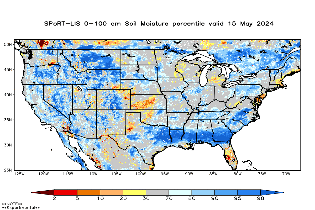
Meteorological summer (June-August) is on the way so let’s put our cards on the table and talk about what we expect this year. Heading into the season, we have had a pretty active spring…although much of the season’s rain fell in early April. Rain totals since Tax Day have actually been close to average and even a bit below average in parts of the area.
We head into the new season in good shape as far as soil moisture is concerned.
As you may know, we construct these seasonal forecasts quite a bit differently than “day to day”, typical short-term weather forecasts. A lot of the data we look at is actually past data. We find time periods in which similar conditions in the oceans were present when compared to this year and the very recent past.
Why the oceans? Because the oceans and the atmosphere are coupled and can greatly influence each other. Cold water and warm water can make the atmosphere do certain things.
HERE COMES LA NINA
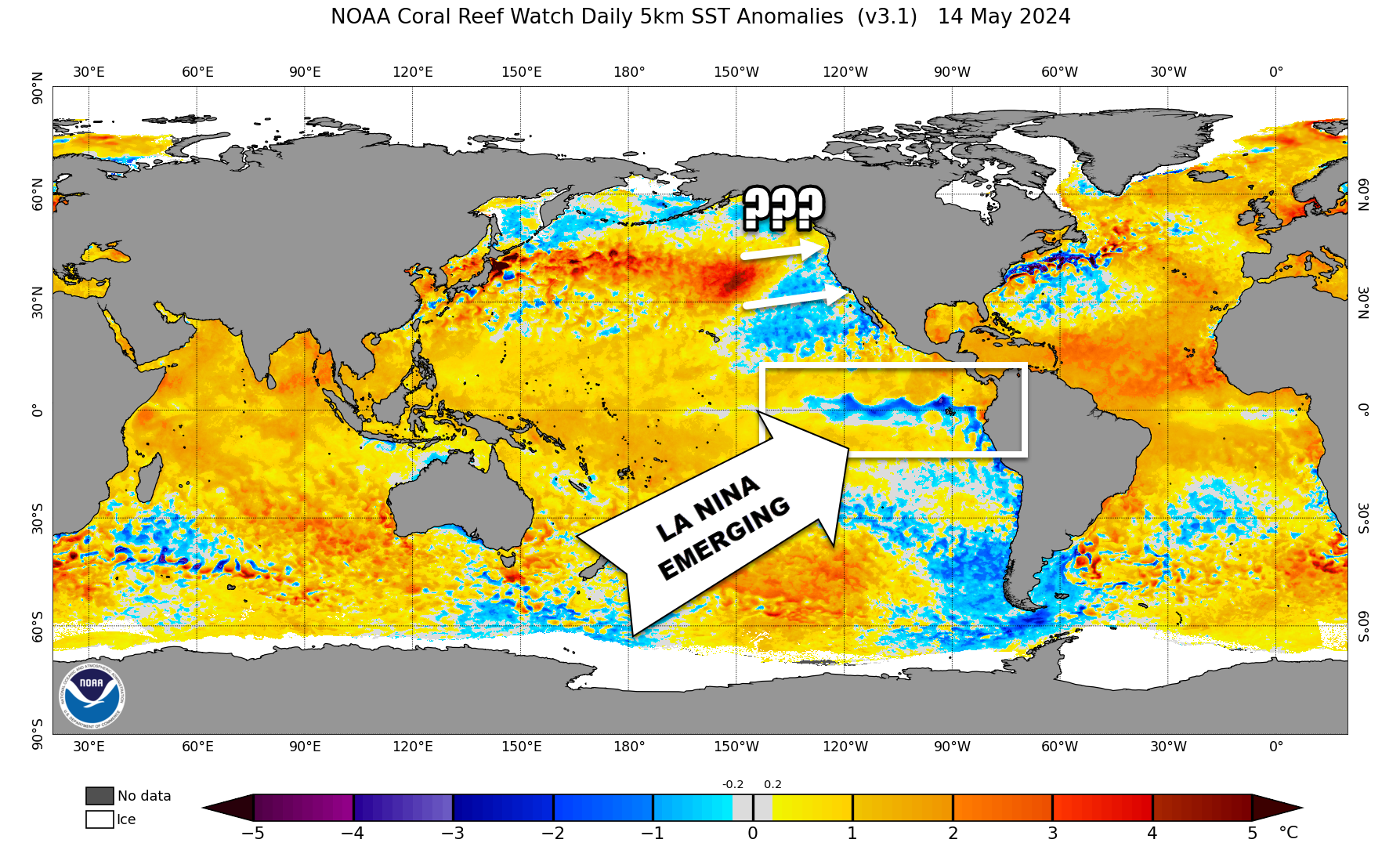
For our summer forecast, one of the more important things going on in the world’s oceans is the emergence of La Nina…or the cooling of the water in the equatorial Pacific. You may remember we had El Nino last winter (and it was a strong one). El Nino has faded quickly and La Nina will take its place over the coming months.
The other region in the Pacific that is important for the United States is the northern Pacific. The arrangement of warm and cool waters (compared to average) can greatly influence jet stream fluctuations downstream…and hence the tenor of our season.
The Pacific right now has a tongue of very warm water, but cooler water near North America. This is known as the negative phase of the “Pacific Decadal Oscillation”. It’s very negative right now, but does it stay that way? Does that warm pool migrate eastward? Big questions that meteorologists are wrestling with.
THE FORECAST
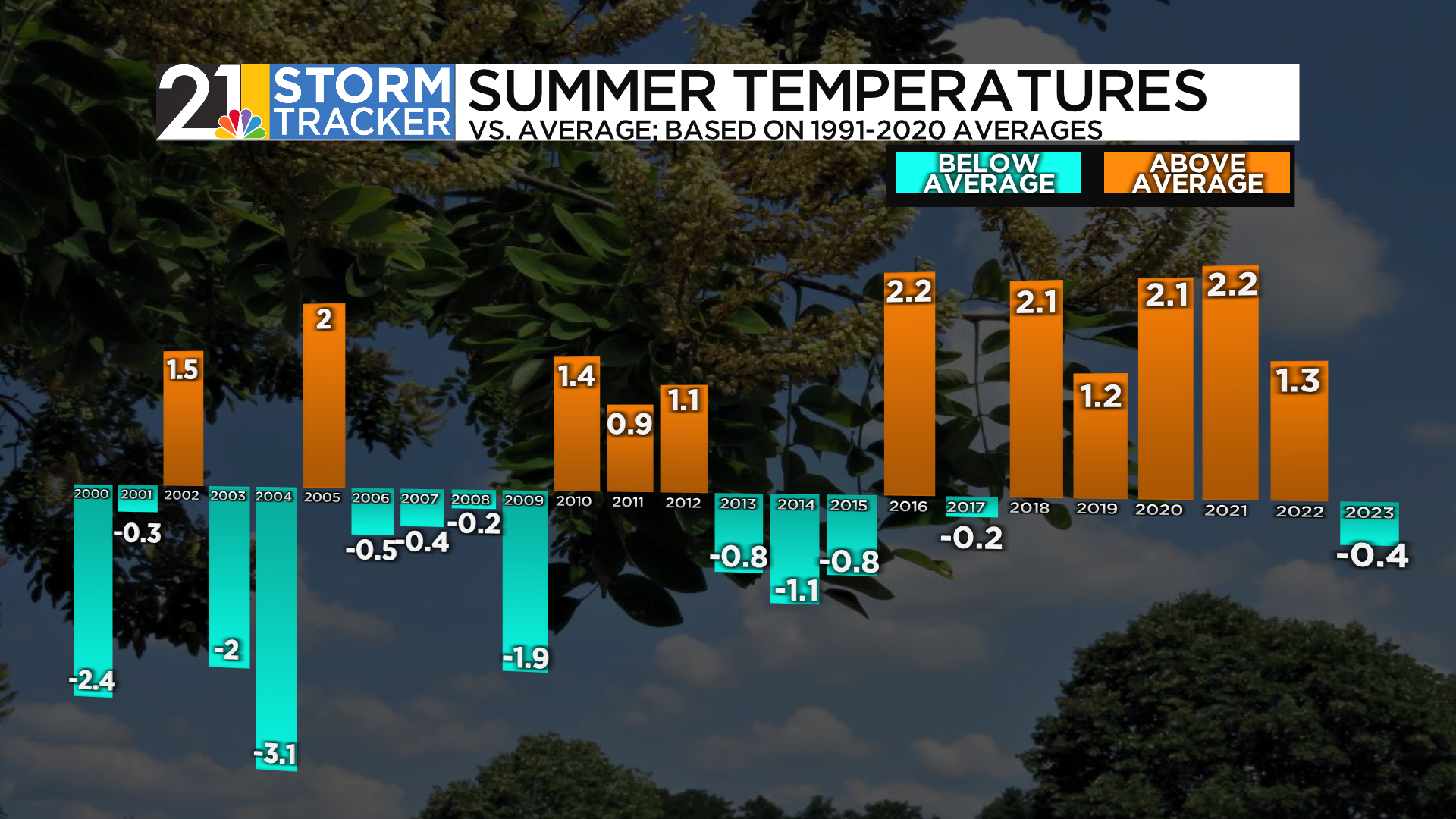
So looking at our “analog” years and using (with caution) some computer model data, what do we think? First off, have a look at our recent summers:
Summer 2023 was not as dry as 2022 and it was our coolest since 2015. In general, our summers have trended hotter and wetter in recent years.
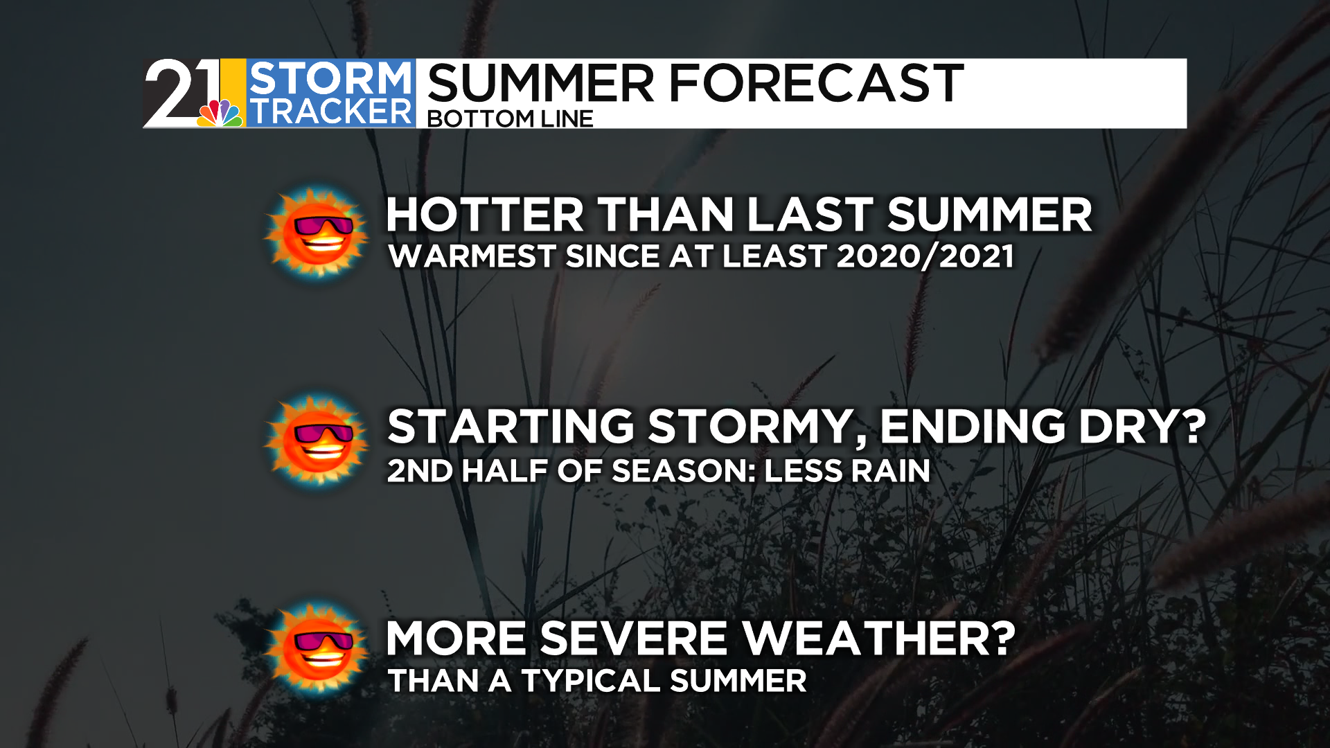
This year? Confidence is high that we will have a hot one….especially compared to last year. The core of the heat is likely reserved for July and perhaps August…June may be fairly tame by comparison.
Rainfall amounts will vary, as they always do in thunderstorm season…but I suspect there will be periods of dryness, perhaps lengthy ones, during the second half of summer. Early summer might bring a continuation of the fairly active spring pattern.
Severe weather may be a concern this summer, even in the middle of a drier overall pattern in July and August. Many of our analog years featured an active thunderstorm regime, with intense bands of storms trekking from the Corn Belt into the Ohio Valley.
Finally, we are expecting a very active tropical season in the Atlantic. This is usually not a big concern for us locally unless we see the remnants of several former hurricanes spread moisture well inland. Either way, it should be a summer/fall full of named systems on weather maps.


